Showing posts with label Road Conditions. Show all posts

Thursday, June 18, 2009

Nabesna Road Conditions


The Nabesna area finally got some much needed rain over the past few days. It has brought the water up in the creeks and made Jack Creek murky but it is worth it to reduce the fire danger. The rain has brought out the flowers (and mosquitoes!) and made things look lush and green. At times like this it’s easy to forget that we live in a semi-arid region.
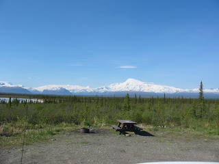

Nabesna Road Conditions as of 10:00 a.m. June 17, 2009:
Nabesna Road is in good to fair condition.

Mile 15 – Mile 17.5: The road is rough in this area with numerous pot holes.

Trail Creek (Mile 29) has shallow water crossing the road.

Lost Creek (Mile 30.8) has a moderate flow of water across the road and has a channel. The bottom is still firm so four wheel drive is not required. Medium and high clearance vehicles are recommended. Low clearance vehicles should use caution.

Boyden Creek (Mile 34.3) has 6 to 8 inches of water flowing across the road and has formed a channel. The crossing is rough and medium to high clearance is required.


Techniques for stream crossings:

  1. Evaluate the stream before crossing. If the water is too murky to see the bottom, find a long stick to probe for depth.
  2. Check to determine if the bottom is firm. If your feet sink into the gravel very much this could mean that the bottom is soft. In the case of a soft creek bottom, you may need four wheel drive.
  3. If you decide to make the crossing, stay committed. Don’t let off the gas once you start across and maintain momentum until you are clear of all water.
  4. Speed should be enough to maintain momentum – you don’t need to “floor it”.
  5. When crossing a channel it is often best to cross at an angle. Look for sloping banks rather than sharp edges.
  6. In the end, only you know your driving ability and your vehicle. Just remember that your cell phone may not work and help is a long way away – maybe even days.

Insider Tips:

Each year around Father’s Day, the Trumpeter Swan pair that nests on an island in Little Twin Lake hatches their cygnets. This year’s batch emerged either late yesterday or this morning. The adults have moved the cygnets over to Big Twin Lake. This requires a cross country hike of about 50 yards! We joke that in addition to web feet, these cygnets are hatched with sneakers. In a few days, they will take another hike of about a quarter mile over to Jack Creek. We don’t know why they do this because it makes the family vulnerable to predators but I think it has something to do with available food for the cygnets.


Wildlife Sightings:

Moose

Red fox

Porcupine

Trumpeter Swans

Thursday, May 28, 2009

Lupine Are Up!


Things are looking pretty green around here – finally. Slana looks like summer but here at the end of the road we are still more spring like. The wild flowers are starting to show up with lupine, and some dwarf fireweed the most obvious from the road. The Memorial Day weekend was busy. Of course that’s relative. There were probably around 10 campsites in use over the course of the entire road!

Note: The next Nabesna Road update will be on Sunday, May 31, 2009.


Road Conditions As Of Wednesday, May 27, 2009 at 3:00 pm:
Nabesna Road is a gravel and dirt surface and is in good to fair condition.

Mile 15 – Mile 17.5: The road is rough in this area with numerous pot holes.

Rock Creek is still very rough with one lane traffic only. DOT is moving fill in so watch for heavy trucks and other equipment in the area.

Trail Creek (Mile 29) is dry.

Lost Creek (Mile 30.8) has shallow water flowing across the road.

Boyden Creek (Mile 34.3) has shallow water flowing across the road.

Mile 36 – Mile 42: Conditions deteriorate and are rough but still passable by any vehicle.

Insider Tips:

It’s always a struggle to describe Nabesna Road conditions. Lee and I drive the entire road round trip at least six times per week. We drive full size four wheel drive pickups. We try to describe conditions so that you realistically know what to expect without discouraging you from driving the road. In the end, you are the only one who knows your vehicle, driving ability and comfort level on gravel roads. We see everything from small sedans to large Class C motor homes that go all the way to the end of the road. We have also pulled four wheel drive vehicles out of numerous creek crossings. Write us a comment if you would like to see more details or additional information. We want your visit to be safe.


Wildlife Sightings:

Moose x2 (5/27)

Snow Shoe Hare (Daily)

Arctic Ground Squirrels (Daily)

Trumpeter Swans (Daily)

Goshawk (5/27)

Yellowlegs (5/27)

Barrow’s Golden Eye (5/27)

Wednesday, March 25, 2009

Welcome to the Nabesna Road blog.


Here it is - the debut posting on the Nabesna Road blog. The purpose of this blog is to share an up-to-date road condition report and share tips for things to see and do on your visit to the northern district of Wrangell-St. Elias National Park and Preserve. I plan to share wildlife sightings including birds but you have to get out there yourself to see them. I'm not going to tell you where they are. Part of the magic of living here and visiting this amazing place is making discoveries on your own. I want to provide insider information that will help your visit be safe and as rewarding as possible. Nothing puts a damper on a visit like having your heart set on hiking the Skookum Volcano Trail only to find that the road is washed out at Boyden Creek just two miles short of the trail head. The National Park Service has a road guide available at visitor centers and on-line.

Current Road Conditions as of March 25, 2009
  • Nabesna Road is in good condition.
  • There is ice on the road at Rock Lake, Mile 21.8, and also near the Skookum Volcano Trail head at Mile 36.2.
  • Icy patches are developing as temperatures warm up during the day but drop down to zero or below at night.
  • Watch for caribou on the road.

Insider Information
We have an approximate snow base of 36" along the road depending on where the wind has shifted it around. Beautiful blue ice falls are visible from Mile 36 on in both the Mentasta Mountains to the north and the Skookum Volcano Formation to the south. With longer and warmer days, this is a great time of year to access backcountry locations. Both Tanada Lake and Copper Lake are popular snowmachine in spots for ice fishing for Lake Trout and Burbot.

Wildlife Sightings

Caribou daily
Lynx (3/24)