Thursday, May 28, 2009

Lupine Are Up!


Things are looking pretty green around here – finally. Slana looks like summer but here at the end of the road we are still more spring like. The wild flowers are starting to show up with lupine, and some dwarf fireweed the most obvious from the road. The Memorial Day weekend was busy. Of course that’s relative. There were probably around 10 campsites in use over the course of the entire road!

Note: The next Nabesna Road update will be on Sunday, May 31, 2009.


Road Conditions As Of Wednesday, May 27, 2009 at 3:00 pm:
Nabesna Road is a gravel and dirt surface and is in good to fair condition.

Mile 15 – Mile 17.5: The road is rough in this area with numerous pot holes.

Rock Creek is still very rough with one lane traffic only. DOT is moving fill in so watch for heavy trucks and other equipment in the area.

Trail Creek (Mile 29) is dry.

Lost Creek (Mile 30.8) has shallow water flowing across the road.

Boyden Creek (Mile 34.3) has shallow water flowing across the road.

Mile 36 – Mile 42: Conditions deteriorate and are rough but still passable by any vehicle.

Insider Tips:

It’s always a struggle to describe Nabesna Road conditions. Lee and I drive the entire road round trip at least six times per week. We drive full size four wheel drive pickups. We try to describe conditions so that you realistically know what to expect without discouraging you from driving the road. In the end, you are the only one who knows your vehicle, driving ability and comfort level on gravel roads. We see everything from small sedans to large Class C motor homes that go all the way to the end of the road. We have also pulled four wheel drive vehicles out of numerous creek crossings. Write us a comment if you would like to see more details or additional information. We want your visit to be safe.


Wildlife Sightings:

Moose x2 (5/27)

Snow Shoe Hare (Daily)

Arctic Ground Squirrels (Daily)

Trumpeter Swans (Daily)

Goshawk (5/27)

Yellowlegs (5/27)

Barrow’s Golden Eye (5/27)

Saturday, May 23, 2009

Moose Independence


I am still having major problems posting to my blogs. Please be patient as I try to work this out - Thanks, Vicki

We are seeing a lot of moose, mainly yearling calves. Moose calves stay with mom for a full year, greatly increasing their chances for survival. But each spring mom and calf go their separate ways before she gives birth to a new calf. This leaves these yearlings looking dazed and confused about this unexpected and maybe not welcome independence. This pair of calves had a good mom. It is unusual for both twins to survive their first year but they aren't getting any special treatment now. Standing out in the open like this is very un-moose like behavior. Moose are solitary animals and rely on stealthy behavior to avoid predators. Before long, these two will start acting more like mom taught them and start spending most of these long days filling up on the rapidly greening willows. These twins may stay together all summer.

Note: The next Nabesna Road update will be on Monday, June 1, 2009.

Road Conditions:
Nabesna Road is in good to fair condition.

Mile 15 – Mile 17.5: The road is rough in this area with numerous pot holes.

Rock Creek is still very rough with one lane traffic only.

Trail Creek (Mile 29) has shallow water flowing across the road.

Lost Creek (Mile 30.8) has shallow water flowing across the road.

Boyden Creek (Mile 34.3) has shallow water flowing across the road


Mile 36 – Mile 42: Conditions deteriorate and are rough but still passable by any vehicle.


Insider Tips:

If you decide to take advantage of this beautiful weather for a little hiking, keep in mind the north facing areas and canyons will still have a lot of ice. Night time temperatures are still below freezing.


Wildlife Sightings:

Moose x4 (5/20)

Trumpeter Swans (Daily)

Boreal Owl (5/20)

Connection Interrupted

Friday, May 15, 2009

Be Ready for any Season When You Visit Nabesna


First of all, let me appologize for the lack of updates. I've been experiencing some technical problems which I think I have worked out.


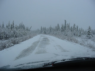
This morning for the third straight day, we woke up to snow. It's not unusual at this time of year but it can sure be a spirit breaker. Summer seems so close and the bushes and trees look they will have leaves any day, but Mother Nature reminds us that she's the one making the weather calls. It's days just like this that are the reason we tell our visiting friends and families to be ready for any season when you're here.


Note: The next Nabesna Road update will be on Wednesday, May 20, 2009.

Conditions:

Nabesna Road is in fair condition
. Thanks to the snow, Nabesna Road is very muddy and slick. The road is rough in places, especially beyond Mile 36. There is shallow water crossing the road in numerous places. Low clearance vehicles should use caution. Four wheel drive is not required but may be helpful when going up hills.


If you have four wheel drive use it. Help is a long way away.


Insider Tips:

There are a lot of moose around right now, mainly cows with yearling calves. Soon these calves will get the boot from dear old mom so that she can give birth to this year’s calf. At least half of the moose killed by cars in Alaska are calves. Remember when you see a cow moose cross the road, there may be a couple of calves following behind her.


Wildlife Sightings:

Caribou x8 (5/13)

Lynx x1 (5/13)

Moose x12 (5/13, 5/15)

Porcupine x1 (5/13)

Trumpeter Swans x4 (5/13, 5/15)

Harlequin Ducks x5 (5/12)

Hawk Owl (5/11)

Migrants that have arrived:

White Crown Sparrows

Yellow Crown Sparrows

Yellow Legs

Barrow’s Golden Eye

Yellow Shafted Flicker

Snipe

Monday, May 4, 2009

Getting Back to Normal


Things are getting back to normal on Nabesna Road. Steve DeWitt and his Slana DOT crew have done a great job repairing washouts and smoothing out channels in the stream crossings. We saw a pick-up camper and an out-of-state car with bikes on it so visitors are starting to arrive. Things are pretty wet on the trails and there's still a lot of ice on the lakes. But as you can see from this photo taken at the Slana River Bridge, Mile 1, Nabesna Road, the ice is out on the Slana.

Note: The next Nabesna Road update will be on Wednesday, May 6, 2009.

Conditions:
Nabesna Road is in fair condition. The road is rough in places, especially beyond Mile 27. Shallow water is crossing the road in numerous locations. Use caution as muddy water limits visibility, making it difficult to see possible channels. Watch for erosion to the road bed. The road shoulders are extremely soft.
Trail Creek (Mile 29) There is a moderate of water across the road. The water is spread out so no channels. We recommend clearance beyond this point. Use caution if taking a low clearance vehicle across.
Lost Creek (Mile 30.8) Same as above except that there is a potential for a channel to develop. The water is spread out but not over a large area.
Boyden Creek (Mile 34.3)
has shallow water flowing across the road.
Intermittent Drainages beyond Jack Creek (Mile 35.3) have shallow water crossing the road.

Insider Tips:
When crossing water on Nabesna Road it is important to maintain your momentum until you are clear of all water. You don’t need to hit the water with a lot of speed. And, if you have four wheel drive use it. Help is a long way away.

Wildlife Sightings:

Caribou (5/4)

Lynx (5/4)

Wilson’s Warbler (5/3)

Barrow’s Golden Eye (5/3, 5/4)

Varied Thrush (5/4)

Yellow Legs (sp?) (5/4)

Golden Eagle (5/4)

Friday, May 1, 2009

She's Out - Nabesna Road is Washed Out In At Least One Location

Well, we knew if was just a matter of time. With spring time snow depths of two to three feet and day time temperatures in the 50's to low 60's, high run-off was a certainty. Water levels will rise as the day warms up.

Note: The next Nabesna Road update will be on Monday, May 4, 2009. We will update the report sooner if conditions change or more information becomes available. Thanks to neighbors Tom and Berta for some of the information.

Conditions:
Nabesna Road is in fair to poor condition. The road is mostly dry but there are some muddy patches that are slick. Water is crossing the road in numerous locations. Use caution as muddy water limits visibility, making it difficult to see possible channels.

Mile 20 has water crossing the road in a greater volume than the culvert can handle. This is causing erosion of the road surface and may create channels across the road.

Rock Creek (Mile 20.5) has a larger volume of water than the culvert can handle and is running down the drainage ditch. Watch for erosion of the driving surface especially close to the ditches.

Trail Creek (Mile 29) Unknown – we were unable to reach that point in the road but suspect a moderate to high flow of water across the road with the possibility that channels have formed. Four wheel drive and medium to high clearance are recommended beyond this point.

Lost Creek (Mile 30.8) Same as above.

Chalk Creek (Mile 31.5) The road is washed out at this point. Water has overflowed a secondary culvert and trenched a channel close to 3 feet deep. Gravel around the was out is very soft.
Boyden Creek (Mile 34.3)
has shallow water flowing across the road. Most of the ice is gone so the crossing is passable by any vehicle.

Intermittent Drainages beyond Jack Creek (Mile 35.3) have shallow water crossing the road.


Insider Tip:

Hey, how's this for a cool photo. Lee took this at about 8:00 this morning at just one of the many places where water is crossing the road.